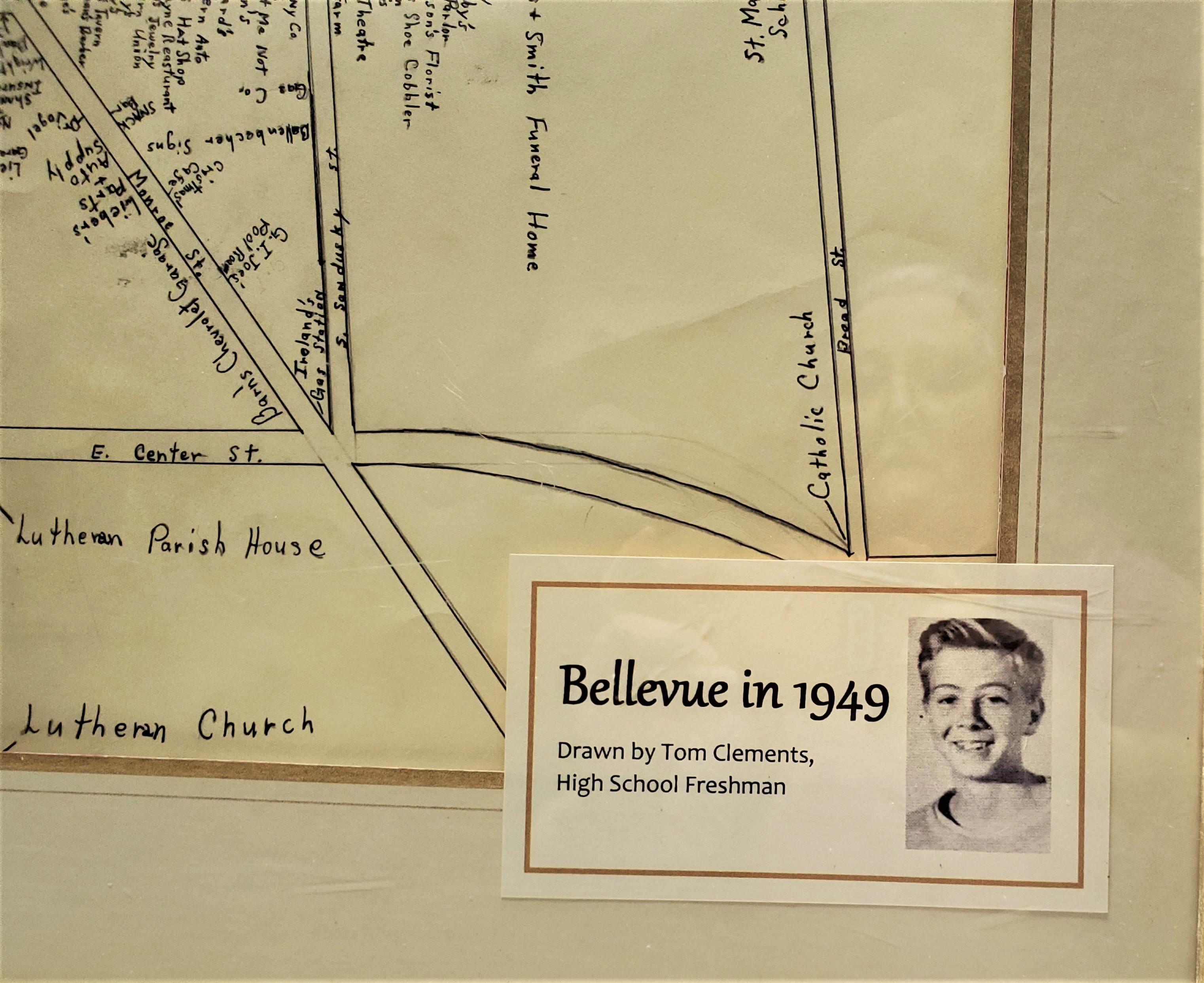
1949 Map of Downtown Bellevue
As a school project in 1949, freshman Tom Clements (who later designed many houses in Bellevue) drew a map showing Main Street and nearby side streets, labeling stores and buildings.
Shown is a small corner portion of the map.
Copies are now available from the Bellevue Historical Society.
- Neatly hand lettered
- 17” X 24” on high quality paper
- Suitable for framing
- Over 125 locations listed – businesses, churches, schools
- Includes Main St. between Greenwood Heights and Broad Street and Includes North Street and Center Street
- Great gift idea!
Proceeds to benefit the Tremont House Restoration Project
$ 20.00 per map - No Shipping (Pick Up Only) at Hunters Needs, 1831 W. Main St., Bellevue, OH 44811 or any board member
$ 32.00 per map - Shipped - (Rolled in Tube)
Choose Pick Up Locally or to be Shipped rolled in Tube